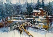
A very unique place in East County, the Peutz Valley Trail/Chocolate Summit, also known as the Anderson Truck trail, could equally satisfy most hikers’ love for wild places and the adrenaline rush for thrill seekers, being mostly known as one of the best and gruesome (on some areas) tracks rides for mountain biking. About 20 miles East of San Diego, take Harbison Canyon Exit and keep straight onto Alpine Blvd to Peutz Valley Road under the freeway.
A very unique place in East County, the Peutz Valley Trail/Chocolate Summit, also known as the Anderson Truck trail, could equally satisfy most hikers’ love for wild places and the adrenaline rush for thrill seekers, being mostly known as one of the best and gruesome (on some areas) tracks rides for mountain biking. About 20 miles East of San Diego, take Harbison Canyon Exit and keep straight onto Alpine Blvd to Peutz Valley Road under the freeway. From there, most people park under the bridge and walk about a mile up the road to the trail head or try their luck to find a parking place closer. The trail is part of the Cleveland National Forest and is 8 miles long one way, most of it in full sun, but with escape routes sideways for shades to cool off.
The first mile starts at an altitude of approximately 2,200 feet and is a double track jeep trail down the hill which makes it a pretty fast ride for mountain and dirt bikes users and four-wheel drivers, if they pass the so called “The Great Wall of Bofus.” This is a huge vertical metal sheet, a man made obstacle to block the trail for four–wheeled and people sprays painted graffiti on it in defiance and still find a way around it. However, just right after Bofus’ wall, the road turns very narrow, explaining the blockage. People on wheels are not advised to go too fast or to go around this drop, as the ravine on the left is pretty steep about 50 feet down and dangerous. There is plenty of room though for hikers and bikers to safely go through. Due to the length of the trail and the alternate ups and downs through the canyons, this is considered an endurance trail more suitable for intermediate hikers and beyond.
At the first intersection on the road, the trail goes down the hill on the left toward the lake and up the hill on the right, continuing on the edge of the El Capitan Reservoir. Right after, there is a wooden board crossing above the Peutz Valley Creek which makes for a little waterfall hidden on the right side of the trail, spreading beautifully across big boulders, creating a heavenly oasis in the shade. Few turns down the road, there is the option to continue to the left on the Conejos path to the lakeshore or straight ahead on Anderson Truck trail, which now starts climbing. The view slowly reveals itself more beautiful and encompassing at every turn, as the lake comes into full view and the surrounding mountains start revealing their majestic curvature – El Capitan Mountain to the west and Viejas Mountain straight ahead.
El Capitan Reservoir was built in 1934 by the El Capitan Dam and is second the largest of its kind in the San Diego, serving flood control purposes and to supply water to the city via the El Capitan Pipeline system. The lake spreads over 1,562 acres when full and with a storage capacity of 112,806 acres. The water reaches 197 feet in depth and the shoreline measures 22 miles across. The lake is one of the few reservoirs in the city that allows visitors to use their own watercraft for waterskiing and water boarding. The El Capitan Dam is 217-foot high and helps store the water collected from San Diego River and Boulder Creek, with its flow controlled upstream at the Cuyamaca Reservoir.
Not far from here, there is a bike trail coming straight down the mountain and the bikers have to make a sharp turn on the main trail, otherwise they risk falling down the steep hill. This is not for the faint of heart or inexperienced riders! Just around here, several cars were driven down the hill and abandoned in the ravine, making for fun rerouting to check them out.
This trail is part of the Chocolate Summit/Peutz Creek Conservation currently own by the San Diego River Foundation This organization received $850,000 in grants few years ago to purchase 152-acre of land between Dehesa and Lakeside for conservation. Golden eagles, deer, bobcats, ring-tailed cat, foxes, San Diego horned lizard, San Diego thorn mint, Lakeside Cheanothus, Tecate cypress, Campo clarkia, San Diego golden star, Quino checkerspot butterfly – these are only few of the species found in the area and worth preserving.
This is part of a larger conservation project of the Upper San Diego River above the El Capitan Reservoir dam that includes El Cajon Mountain. Many experts qualify this region as the country’s most diverse open space when it comes to species and habitat, counting San Diego banded gecko, Bell’s sage sparrow, Rufous-crowned sparrow, and San Diego black-tailed jackrabbit among them. Let’s don’t forget our national rarest oak, the Engelmann. The San Diego River gorge acts like a passageway for transgressing wildlife in an area where some homesteads are over a hundred years old overlooking breathtaking vistas all the way to the Pacific Ocean.
Be prepared for an unique outdoor experience, suitable for the whole family if choosing to do just part of the trail. The whole hike is 16 miles long both ways and it takes the whole day to do it, so pack plenty of water, grab your hat, and don’t forget your sunscreen and healthy snacks. Inhale, and then exhale. Now take the first step and you’re on your way to one of the most exciting adventures in East County, San Diego.


