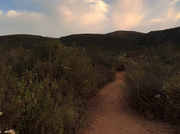
Mission Trails Regional Park is a vast place, offering 5,800 acres of rugged hills, valleys and open areas to roam. People flock every weekend to Cowles Mountain, Lake Murray, the Visitors’ Center, and the Oak Grove Trail. But its trails in Santee leading to peaks and viewpoints are worth just as much exploration.
Mission Trails Regional Park is a vast place, offering 5,800 acres of rugged hills, valleys and open areas to roam. People flock every weekend to Cowles Mountain, Lake Murray, the Visitors’ Center, and the Oak Grove Trail. But its trails in Santee leading to peaks and viewpoints are worth just as much exploration.
Going east on Mission Gorge Road, turn south on Big Rock Road in Santee. At the dead-end of the Road and behind several homes lies a system of deep canyons. The canyons are interlaced with trails leading to Pyles Peak or Cowles Mountain, depending on which way is taken. The trails also connect with those adjacent to Big Rock Park. The cool of the morning or evening is the best time to explore these oases of green and wildlife.
On one evening as I walked up that trail off Big Rock Road, I came across a coyote that quickly darted through the sage scrub. The trail was well marked, with a fairly steep incline. Several finches gathered in a tree for their evening song. I walked for 45 minutes, going higher and higher. I turned around when I saw that I had about half an hour until dusk. On my way down, a California Towhee rang out its metallic trill, calling for its lifelong mate.
On another evening, I chose the trail that started off Mesa Road adjacent to Big Rock Park. Cottontail rabbits hopped away from me as I ambled on admiring the scenery. Cowles Mountain loomed in the distance. The trail connected up with the one I’d been on the other evening, off Big Rock Road. From my vantage point, I could see that trail’s entrance.
This time I went higher up on the slope. Mountain bikers rang their bells on the way down, so I was able to make room for them. We greeted each other, remarking on the beauty of the evening. The shadows were getting longer, and the sound of traffic further and further in the distance the higher I went.
The trail, though switchback and steep, was well maintained, with planks used as steps. Manzanita tree branches interlaced alongside the trail. The sounds of civilization had gotten further behind. Whispers and titters of birds moved among the trees.
I had twenty minutes before dusk, so I turned around to go back. I was glad I had worn hiking shoes because the way down was rather slippery in places.
The last leg of the trail actually starts further up Mesa Road past the park. There is a small dirt parking lot and a signpost indicating the beginning of a trail leading up to the backside of Cowles Mountain. Biplanes from Gillespie Field were circling high above on the evening I went. The trail started out as a wide road. A creek ran under some large boulders where frogs croaked and birds flitted about. Back on the main road, a path on the right lead to a wooden walkway over the creek and the ascent quickly began.
This path was much steeper than the one I had explored adjacent to Big Rock Park. The sun dipped over the peak. Behind and below me, everyone’s homes and cars looked like toys. A siren sounded in the distance on Mission Gorge Road. Neighborhood dogs started howling, and then a chorus of uncanny wails began. I stopped in my tracks, listening and looking. Those were not the cries of neighborhood dogs. I was sure I was hearing coyotes.
That was a signal for me to begin my descent. A family of five was just ahead of me on their way down, too. The Black Sage around me smelled divine. By the time I reached the wide path down below, the sun had already dipped below the horizon. A juvenile Anna’s Hummingbird was ecstatic in chasing insects. An iridescent red flashed on the tiny bird’s throat.
All these hikes should be avoided during mid-day, especially during the dog days of summer. Besides, more birds and wildlife are apt to come across your path in the morning and evening.
For a map of roads and trails in Mission Trails Regional Park, go to https://www.mtrp.org/trail_map.asp.


